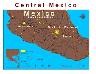
 I had trouble with the annotation conversion for the city labels in this exercise. I think the TS lagtime might have played a role since I ended up with two or three different labels for each city. Again I saved, saved, saved so starting over was not as frustrating as in the last exercise.
Since we were not relating any other spatial information that required a change in my world countries layer color, I kept the brown from Exercise #1. Another change I made is to the color that represent railroads. My old eyes could not see those tiny tracks in the default symbol so I changed the color to fire red and moved the layer to below highways so it would not overwhelm the map.
What do you think?
1 comment:
Hi Sue,
Good job on this weeks exercise. I would suggest toning down the colors, that's just me. Overall, you did a great job.
Leah
Post a Comment