
01 June 2010
06.02.10 Deliverable #5
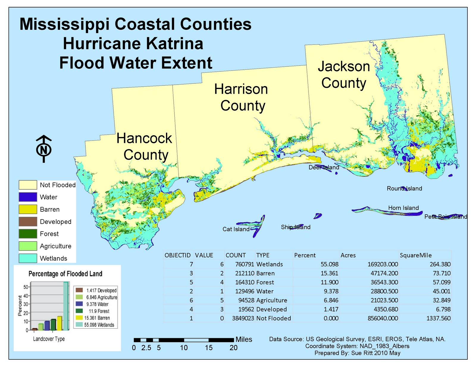
The Mississippi Coastal Counties Hurricane Katrina Flood Water Extent Map was made for the University of West Florida's Applications in GIS class project for Unit 3: Hurricane Analysis. Initially students were required to present a layout view map showing elevation, hydrography, and Bathymetry of the Mississippi Coast counties with places, types of water, barrier islands, and hydrography. By adding the US Geological Survey land cover file and reclassifing land cover types into 7 catagories, students were then directed to submit a graph detailing flooded areas by land cover type. Finally, we were asked to create a table detailing the land cover types affected by the storm surge expressed as a percentage, by acreage totals per land type and by square miles.

Subscribe to:
Post Comments (Atom)
1 comment:
I really like the way you incorporated all the elements of the assignment here... I hadn't thought of putting the table on the map... a good call!
Post a Comment